Home / Field Notes / Survey tools
Field Notes · ResidentialNot a shopping list. Every tool on a survey truck earns its place by measuring one thing and preventing one expensive error. This is the kit, organised that way.
A working solar site survey kit covers nine jobs: a tape and laser measure for plane dimensions, a pitch gauge or inclinometer for slope, a compass for azimuth, a shade or horizon tool for each array area, an attic kit (light and tape) for rafter size and spacing, electrical PPE with a meter and a panel photo checklist, a ladder with fall protection, a drone for measurement photos, and a phone or tablet to capture and review it all before leaving the site.
Most lists of solar site survey equipment read like a hardware store receipt: what to buy, not why it is on the truck. The better test is the one the office applies later: which number on the plan set came from this tool, and what does it cost if that number is wrong?
Seen that way, every tool maps to a specific downstream reader. The designer lives on plane dimensions, pitch, azimuth and shade; the engineer on rafter size, spacing and span; the utility and permit office on the panel. A tool that feeds none of them is weight. A missing tool is a return visit.
For the full capture list rather than the kit, see the site survey checklist, built backwards from rework.
Hover or tap a tool. The house lights up where that tool does its work, and the readout names the error it exists to prevent.
MeasuresPlane lengths at eave, rake and ridge; obstruction offsets; attic spacing.
Error it preventsA layout drawn on traced geometry that loses a row of modules on install day.
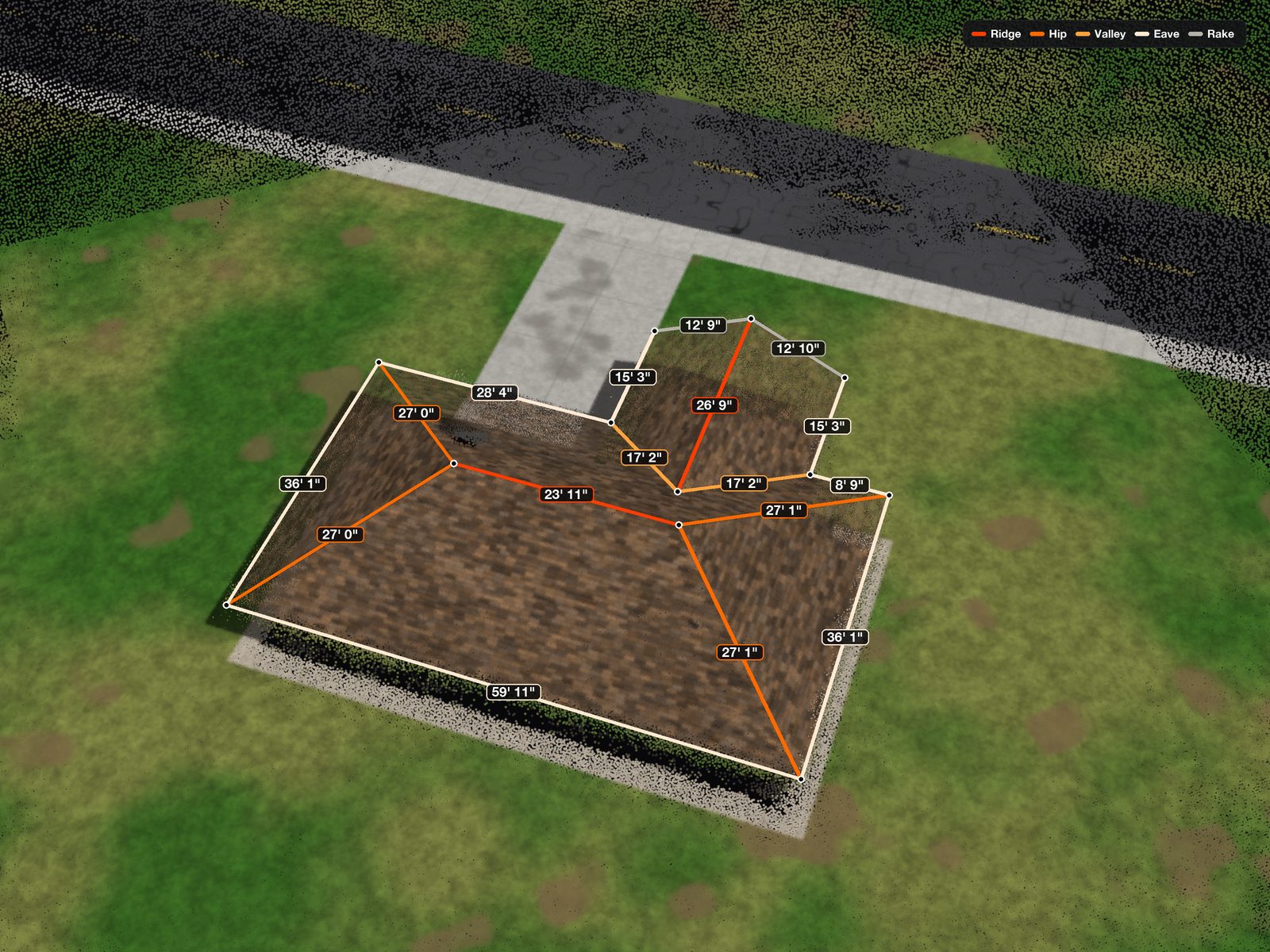
Measures: plane length at the eave, rake and ridge, and the offset from each obstruction to the nearest edge. Prevents: a layout drawn on traced geometry. Overhangs, gutters and parallax hide the true plane edge in imagery, and a plane a foot shorter than the drawing can lose a row of modules.
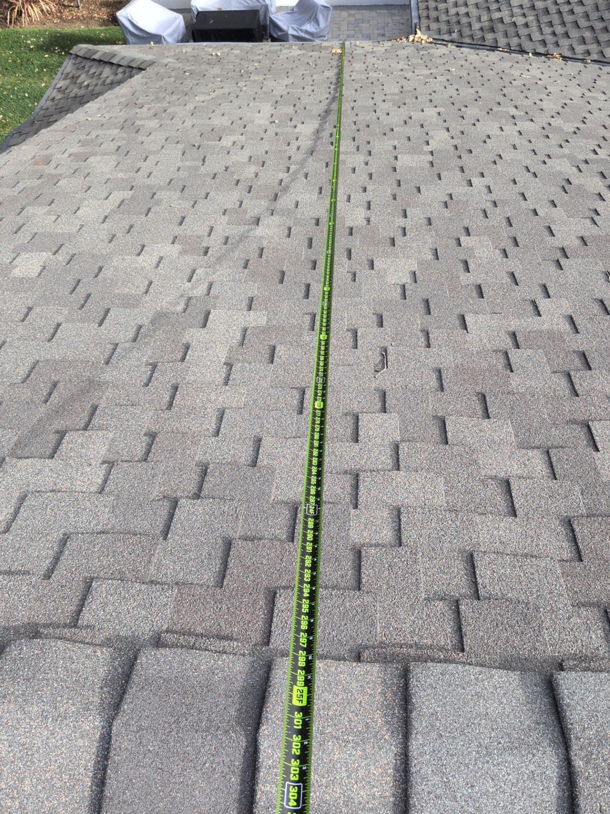
Carry both. A long tape run from eave to ridge on the plane itself is the reference you trust, and it doubles as a known scale for any photo-based model. A laser measure is faster for eave-to-eave runs from the ground or across a plane you cannot safely walk. When the two disagree, re-shoot before you climb down.
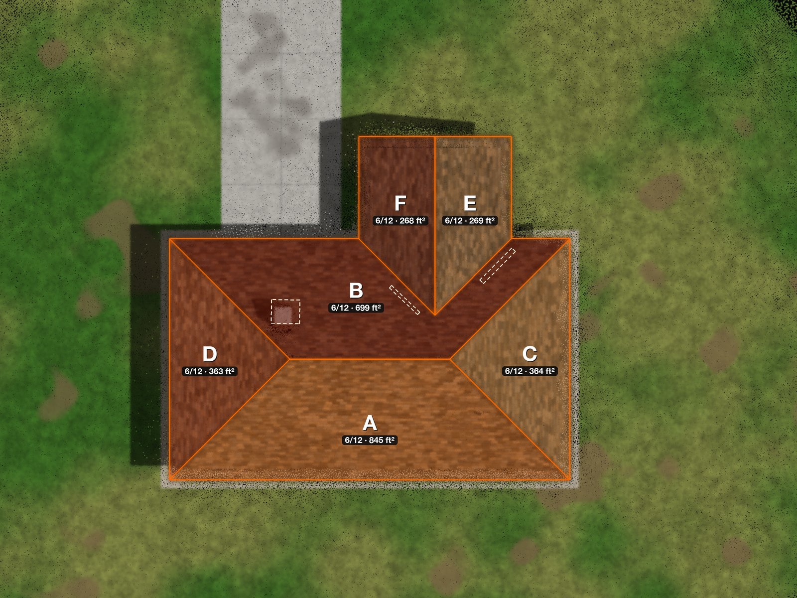
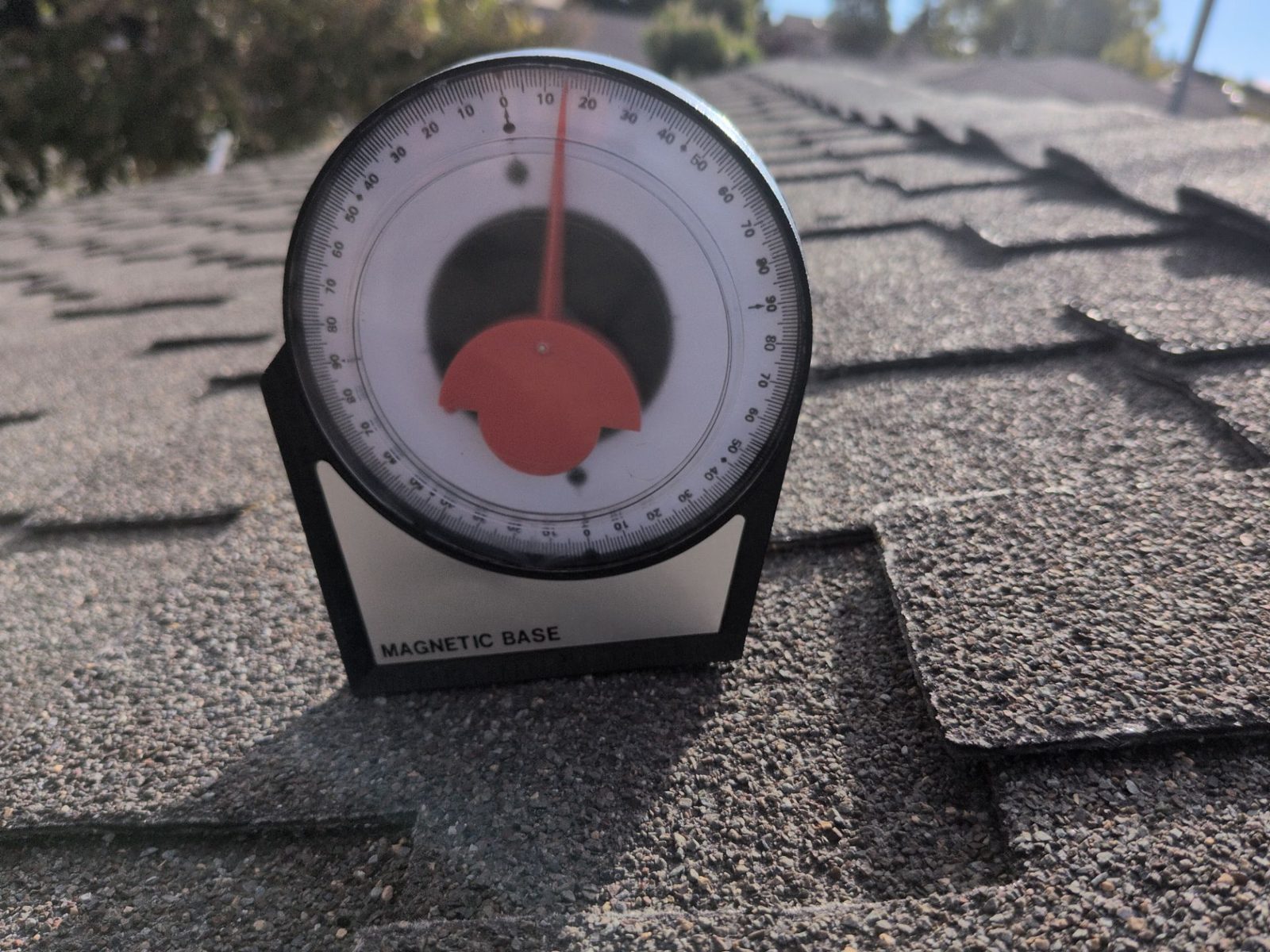
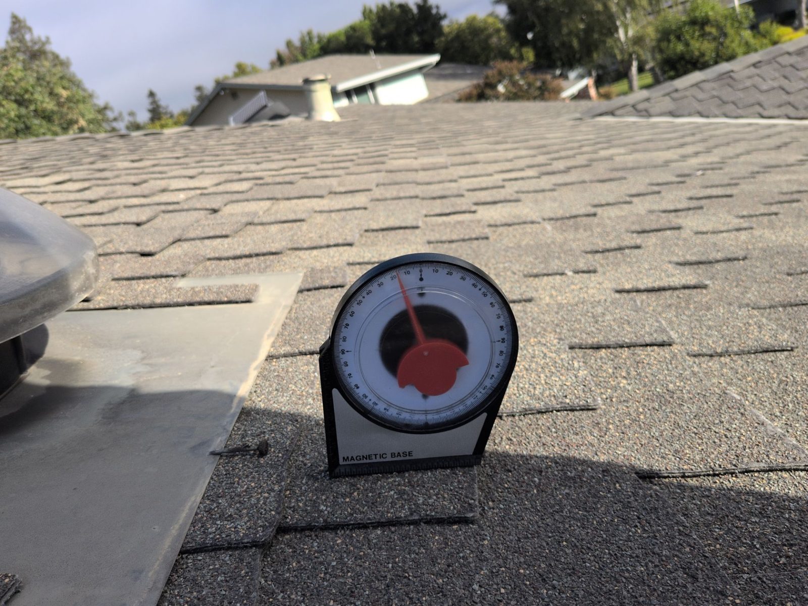
Measures: the slope of each plane. Prevents: a production estimate and a wind and snow check built on the wrong angle. Read the gauge seated on the plane, not on a ridge cap or a raised shingle edge, and read every plane: additions and dormers rarely match the main roof.
Illustrative: pitch is recorded as rise over 12. A 5/12 roof is about 22.6°; a 6/12 roof is about 26.6°. One step on the gauge is roughly four degrees of tilt, which is enough to move the production figure and can change the inputs to the engineer's wind and snow check.
Measures: the azimuth each plane faces. Prevents: a production estimate pointed the wrong way. Two things trip technicians up. First, a magnetic compass reads magnetic north, while design tools generally expect true north. The difference, magnetic declination, depends on where you are and can run past ten degrees in parts of the United States. NOAA publishes a declination calculator; note which reference your reading uses. Second, a phone compass is easily pulled off by flashing, vents, a metal roof or the service panel. Take the reading away from metal and sanity-check it against the street grid.
Measures: the obstructions on the horizon, as seen from each array area. Prevents: a shade loss that nobody saw coming. The rule that matters is location, not the device: capture from each proposed array area, not once from the middle of the roof. A tree that shades the west plane can be invisible from the east one. Note whether each tree is on the property, and flag near obstructions that only matter in winter, like a chimney or a taller neighbour. Our shading analysis page shows what that capture becomes.
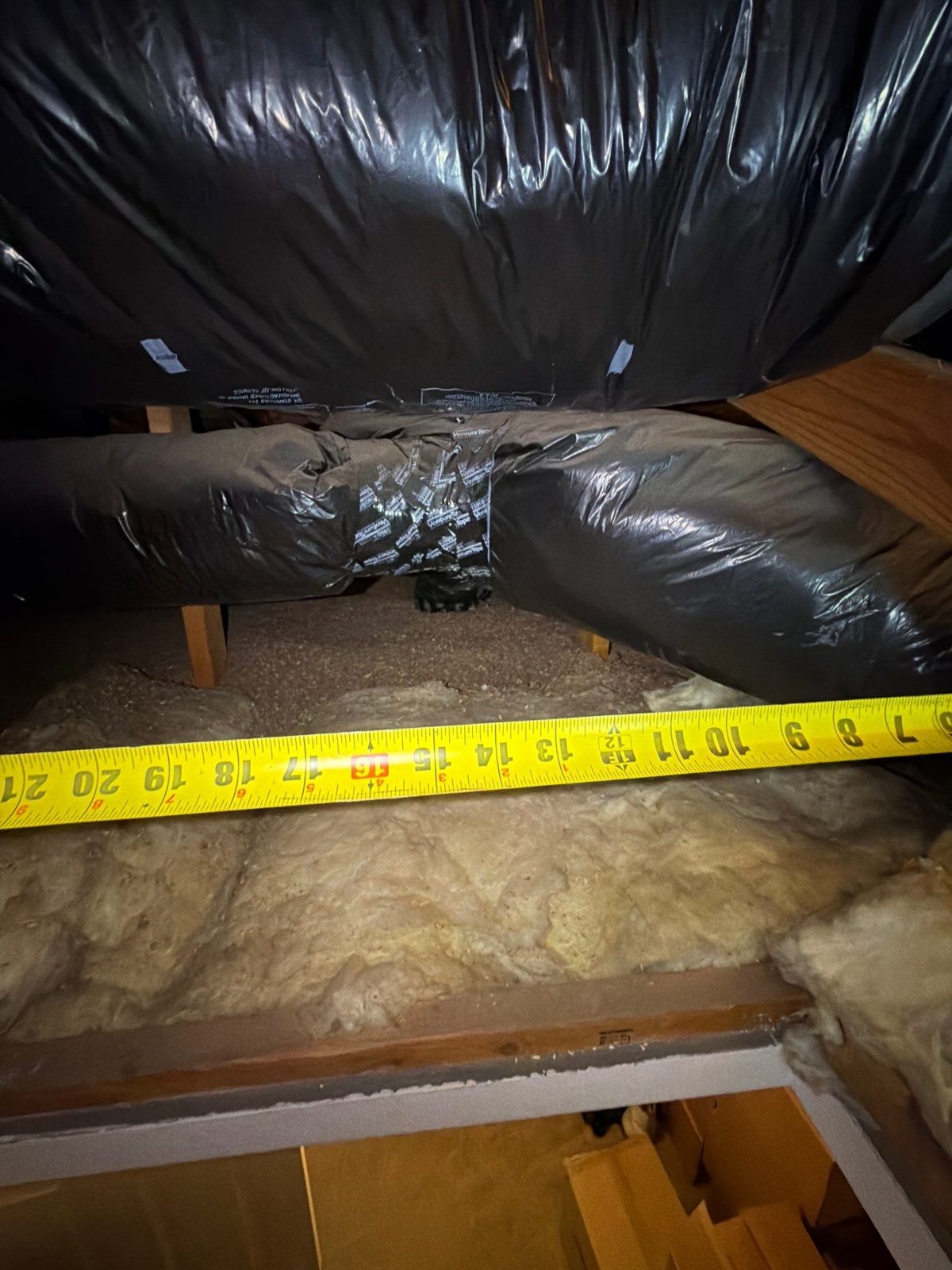
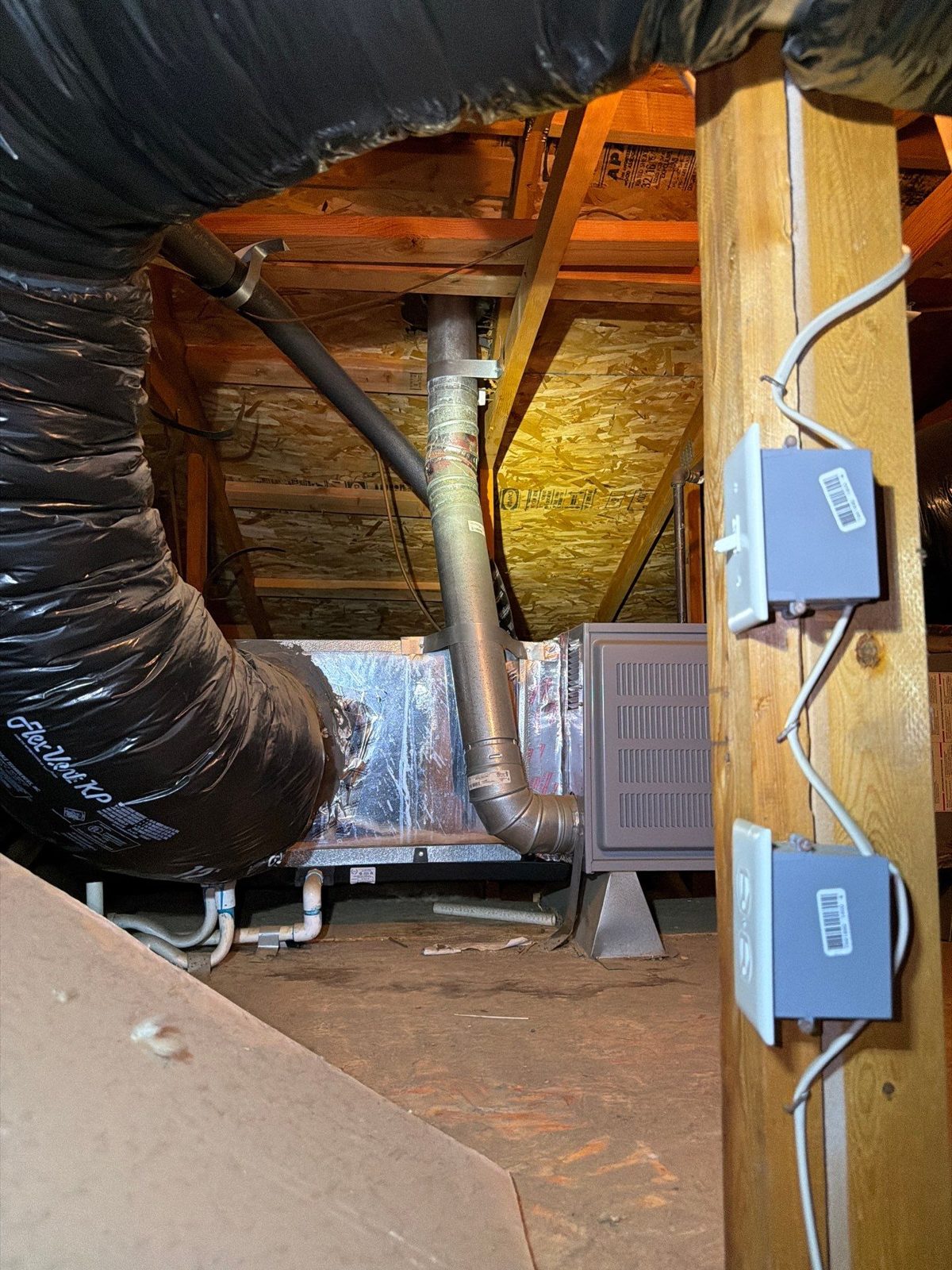
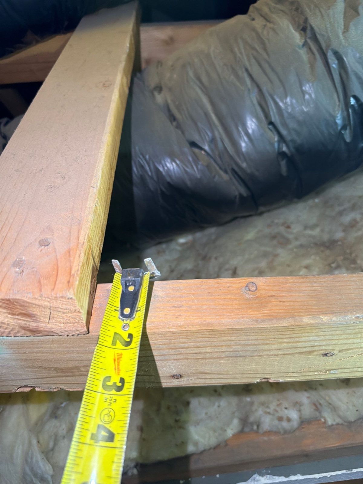
Measures: rafter or truss depth and width, on-centre spacing, span, and sheathing type. Prevents: a structural letter written against assumed framing. The engineer cannot see through the roof, and neither can a drone. This is the one input that has to be read by hand.
The kit is small: a headlamp and a handheld light, a tape, knee pads, and a board to walk on across the joists. Measure the actual depth of the member, hooked to the underside of the sheathing, because a nominal 2x6 is about 5½ inches deep and older framing does not always match modern lumber. Lay the tape across several bays to confirm spacing, since 16 and 24 inches on centre look similar in a dim attic and change the attachment layout. Photograph anything that limits attachment: ducts, an air handler, junction boxes, sagging or damaged members. See the attic and structure page for how we record it.


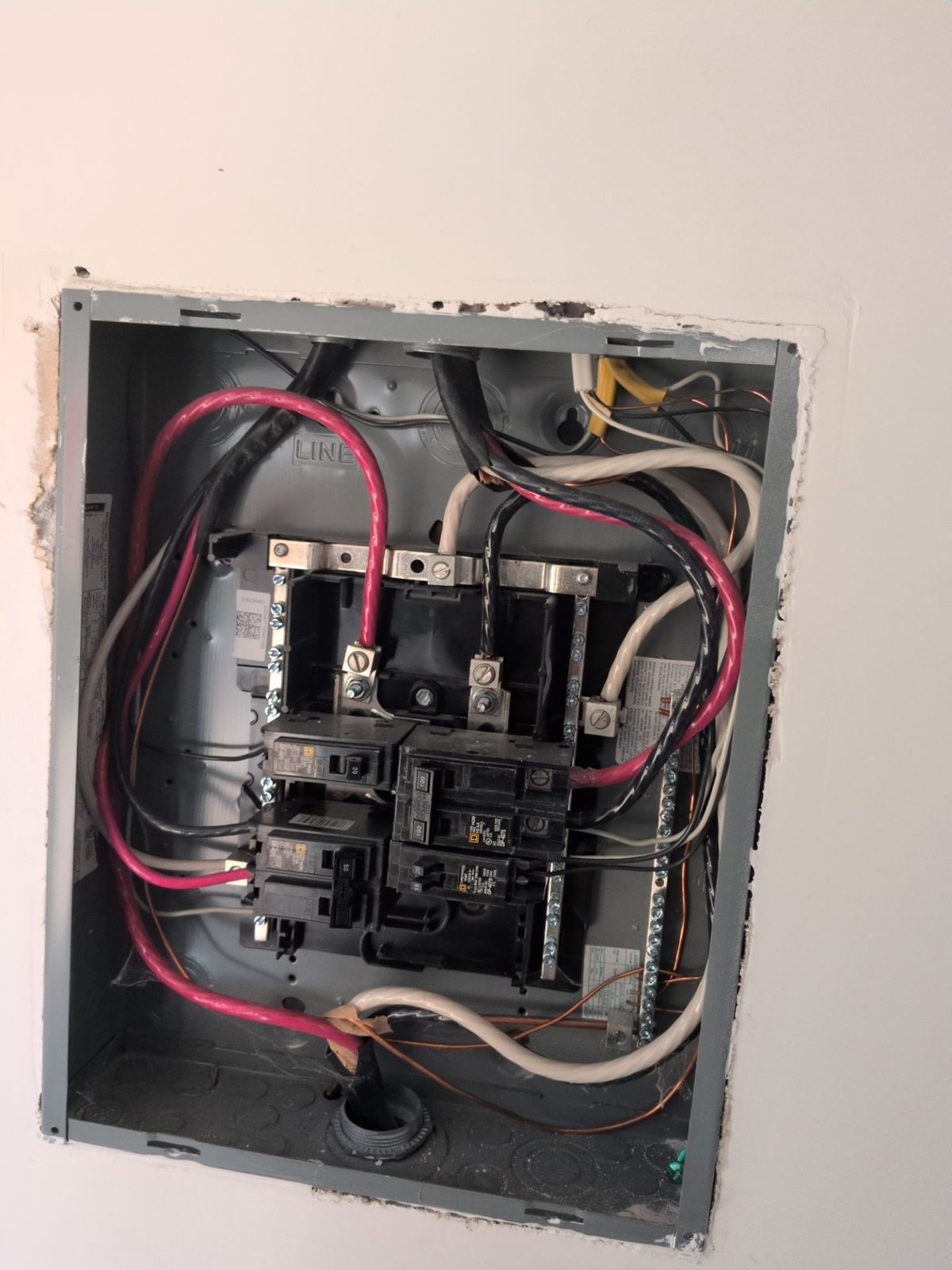
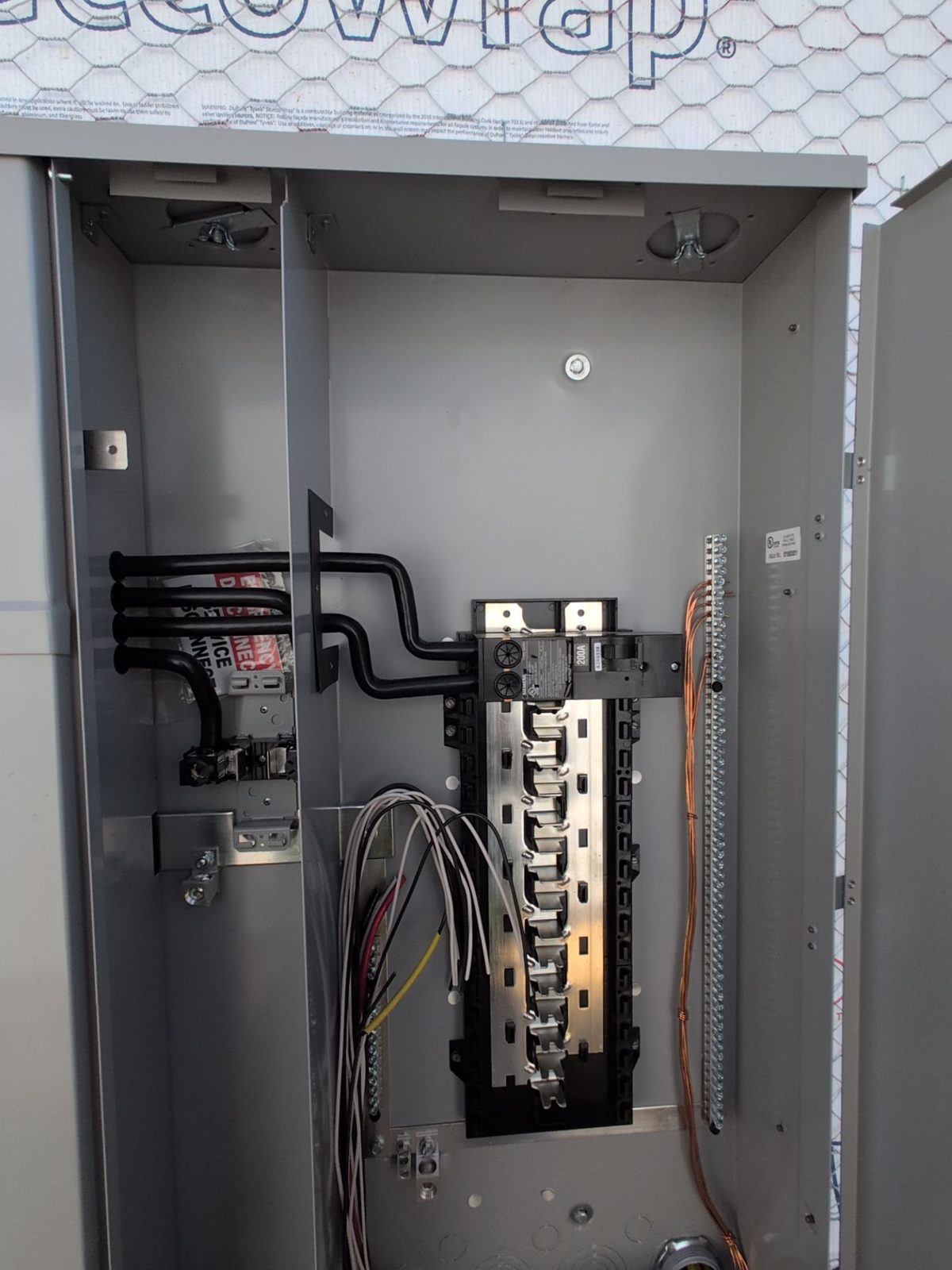
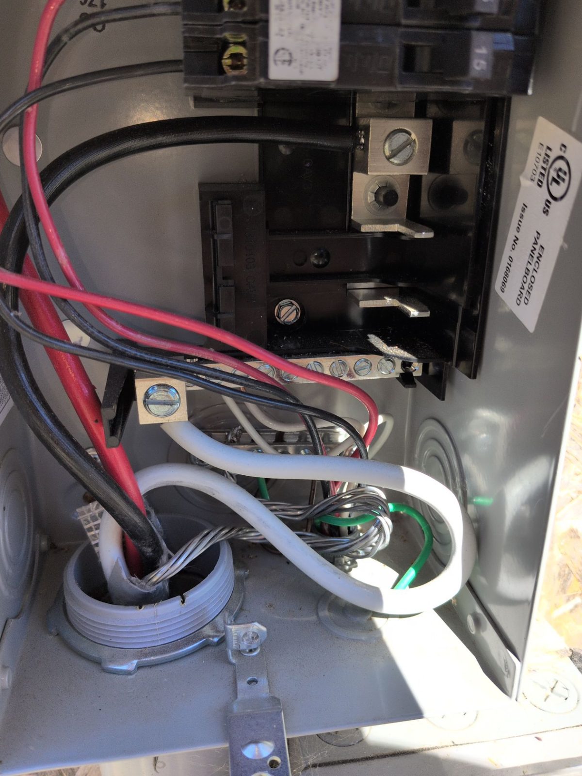
Measures: the main breaker and busbar ratings, open slots, service size, meter details and the grounding path. Prevents: a common and avoidable redesign: a plan set drawn against a busbar rating nobody verified. The main breaker and the busbar are often rated differently, and the busbar is the number the interconnection math is checked against.
Treat the electrical kit as three parts. PPE sized to your company's electrical safety program: safety glasses, voltage-rated gloves where required, and arc-rated clothing if the task calls for it. Only a qualified person removes a dead front. A meter rated for the measurement category of the equipment it will touch, if your program allows live verification at all. Many survey programs are photo-only. A photo checklist, which does more work than either: the panel label, the main breaker, the busbar rating, the full interior with every breaker legible, the meter number and the service entrance. The electrical and interconnection page shows the full shot list.


Measures: nothing. Prevents: the worst outcome on any job, and a survey that stops at the gutter because nobody could get on the roof safely. For residential construction, OSHA 1926.501(b)(13) requires guardrails, a safety net or a personal fall arrest system at 6 feet or more above a lower level, with a written fall protection plan allowed only where those are shown to be infeasible. Whether a given survey is treated as construction or general industry work is worth confirming with your safety lead.
For ladders, OSHA 1926.1053 calls for side rails that extend at least 3 feet above the landing and a setup angle where the base sits about a quarter of the working length out from the support. In practice the kit is a ladder tall enough for the two-storey jobs, a ladder stabiliser or standoff so it does not bear on the gutter, a harness and lanyard, and a roof anchor. Record the ladder point you used: the install crew needs it too.
Measures: nothing directly. It captures the overlapping photos a dimensioned roof model is built from, plus the planes and obstructions you cannot safely walk. Prevents: a missing plane or an unmeasured steep face. The photos only become measurements with a known scale, which is why the tape run on the roof still matters. Commercial drone work in the United States also requires an FAA remote pilot certificate under Part 107.
Measures: it records everything else. Prevents: the return visit. The capture app is where the checklist lives, and its most important feature is the review step: every photo checked on the device before the truck leaves. Blurry, dark and cropped-too-tight are recoverable on site and expensive afterwards.


Check it before the first job of the day.
| Tool | Measures | Error it prevents |
|---|---|---|
| Tape and laser measure | Plane edges, obstruction offsets | Layout on traced geometry |
| Pitch gauge or inclinometer | Slope of every plane | Wrong production and structural inputs |
| Compass | Azimuth per plane | Estimate pointed the wrong way |
| Shade or horizon tool | Horizon from each array area | Unseen shade loss |
| Attic kit | Member size, spacing, span, sheathing | Structural letter on assumed framing |
| Electrical PPE, meter, photo list | Busbar, main, slots, meter, service | Interconnection redesign |
| Ladder and fall protection | Safe access | Injury, and an unfinished survey |
| Drone | Photos for the roof model | Missing or unwalkable planes |
| Phone or tablet app | Everything, reviewed on site | The return visit |
Our site survey puts one technician on the roof, in the attic and at the service panel in one visit, with the deliverable back within 48 hours. The zone pages show the kit at work: roof and drone capture, attic and structure, and electrical and interconnection.
Tape and laser measure, pitch gauge, compass, shade or horizon tool, an attic kit (light and tape), electrical PPE with a panel photo checklist, a ladder with fall protection, and a phone or tablet for capture. Many crews add a drone for measurement photos.
It can be a useful cross-check, but a phone compass is easily pulled off by nearby metal such as flashing, vents and the service panel, and it reads magnetic north unless the app corrects for declination. Read pitch with a gauge seated on the plane and treat the phone as the capture and review tool.
Usually, yes. A magnetic compass points to magnetic north, while design tools generally expect azimuth relative to true north. The difference, magnetic declination, varies by location and can exceed 10 degrees in parts of the United States. NOAA publishes a declination calculator.
For residential construction, OSHA 1926.501(b)(13) requires guardrails, safety nets or a personal fall arrest system at 6 feet or more above a lower level, with a fall protection plan allowed only where those are shown to be infeasible. Whether survey work falls under the construction or general industry rules is worth confirming with your safety lead.
Not on its own. Drone photos are good for building a dimensioned roof model and documenting planes you cannot safely walk, but a tape-measured reference on the roof gives the model a verified scale, and the attic and electrical data still have to be captured by hand.
Bring your monthly job count and the AHJs you submit into.
Book a 15-min callIn-person site surveys, engineering and inspection for residential, C&I and utility-scale solar, delivered as live data.